Restoring the Chesapeake Bay
18
Wetlands
Chesapeake Bay
Restoration
The Chesapeake Bay is among the greatest ecological treasures of North America. It is the largest estuary in the United States and, according to NOAA, among the most productive bodies of water in the world. Some, without scientific evidence, also believe it is one of the most beautiful places on the planet.
The Bay is home to more than 3,600 species of plants and animals, including 348 species of finfish, 173 species of shellfish and even 16 species of precious underwater grasses. Almost one million waterfowl winter around the Chesapeake Bay. Roughly 500 million pounds of seafood are harvested from the Bay annually.
However, the Chesapeake Bay is also unhealthy. Since 1998, the EPA has listed most of the Chesapeake Bay and its tributaries on its 303d list of impaired waters. Every summer a dead zone emerges in the main stem of the Bay. A lack of oxygen creates hypoxic conditions that are fatal to marine life. Shellfish harvesting is prohibited from many portions of the Bay and its tributaries.
Nutrient pollution (an oversaturation of nitrogen and phosphorus) is the main problem for the Bay. These pollutants enter the Bay from a variety of sources, including atmospheric deposition, residential and commercial development, wastewater treatment plants, septic systems and agriculture. Historically, wastewater treatment plants and agriculture have been among the largest sources of pollution (more on these two issues below).
Environmentalists have advocated for restoring the Chesapeake Bay for decades. Multi-state plans were developed in 1983, 1987, 2000 and 2014. Billions of dollars have been spent trying to address nutrient pollution.
And yet, the Bay’s health continues to limp along. According to the Virginia Institute of Marine Science, the dead zone in 2021 was not only larger than average but it also lasted significantly longer than the thirty-five year average.
So, what makes restoring the Chesapeake Bay so difficult?
Geography
The Bay’s geography plays an important role in making it such a remarkable ecosystem. It is almost 200 miles in length from the mouth of the Susquehanna River north of Baltimore, MD, to the Bay’s mouth at the Atlantic Ocean south of Norfolk, VA. Its coastlines provide food and shelter for a great diversity of wildlife. The shallow nature of this estuary allows sunlight to produce abundant life in its waters.
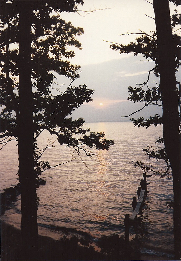
The Chesapeake Bay is among the most productive and beautiful ecosystems in North America. Unfortunately, pollution has impaired its water quality. Here the sun sets over the main stem of the Chesapeake and Annapolis, MD.
Photo courtesy of Chris Pupke.
However, its geography also makes the Chesapeake extremely vulnerable to pollution from the land. According to the Chesapeake Bay Program, the Bay and its tidal tributaries have more than 11,600 miles of shoreline. This is more shoreline than the Pacific coastline from Seattle to San Diego. And inland, there are more than 100,000 miles of streams.
Additionally, the Chesapeake Bay is a shallow body of water. The mainstem of the Bay averages about 27 feet in depth. This figure drops to 23 feet in depth if its tidal tributaries are included. Scientists estimate that 10% of the Bay is less than three feet deep. For comparison, Lake Ontario, the smallest of the Great Lakes, has an average depth of 283 feet and has 40 times the amount of water as the Chesapeake Bay.
The Chesapeake Bay watershed is over 64,000 square miles. The Chesapeake’s land-to-water ratio is 14:1, making it the largest such ratio of any coastal body of water in the world. The watershed is located in six different states (Delaware, Maryland, New York, Pennsylvania, Virginia and West Virginia) and the District of Columbia. This geopolitical reality complicates efforts to restore the Bay.
When taken together, these geographic facts mean that the behavior of people on the land has a tremendous impact on the water in the Chesapeake Bay. But while this geography makes restoring the Chesapeake more difficult and complicated, it does not make it impossible.
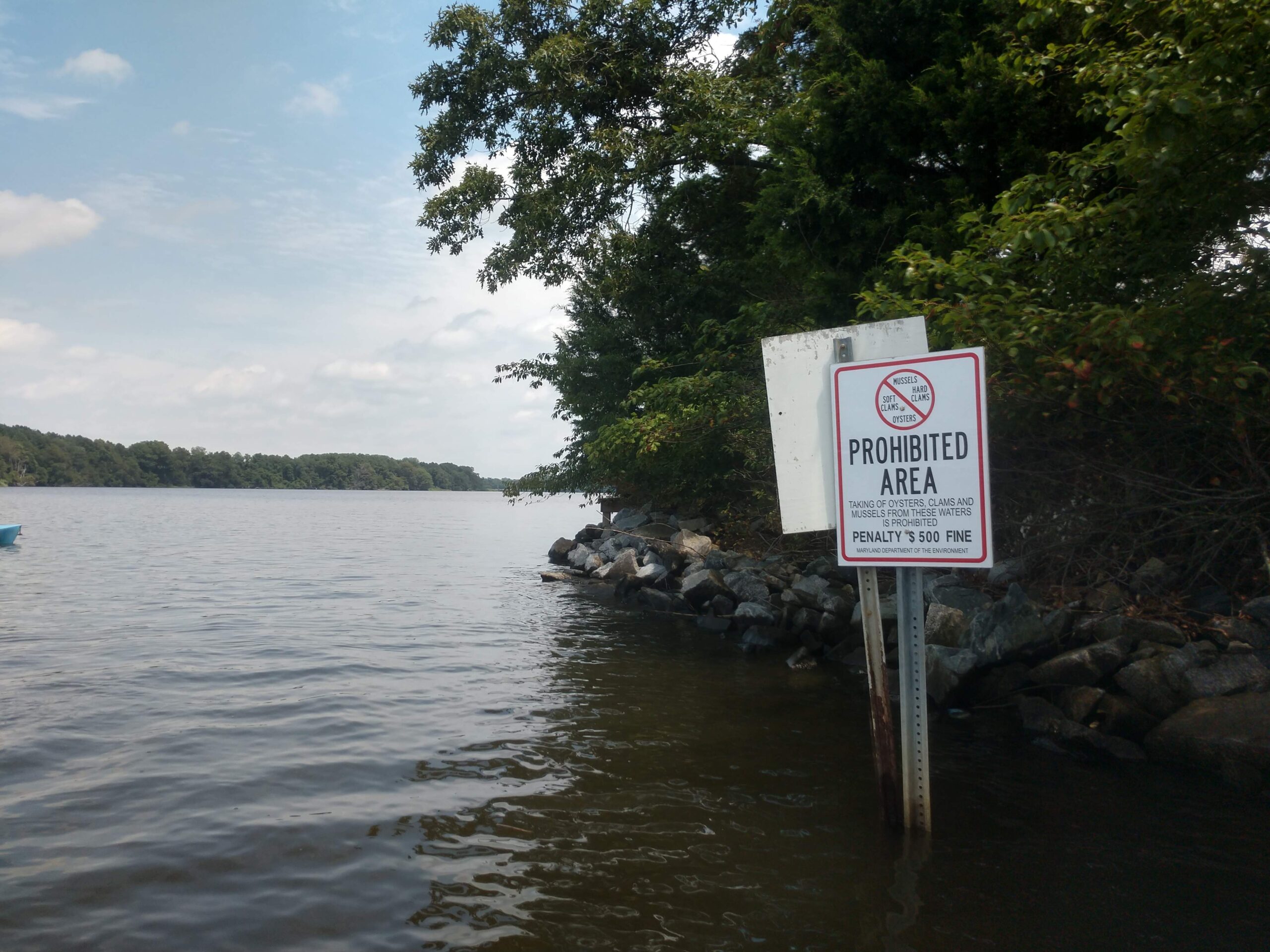
The Chesapeake Bay is famous for its blue crabs and oysters among many other delectables. However, many portions of the estuary are closed to shellfish harvests due to polluted waters including this stretch of the Wye River.
Photo courtesy of Chris Pupke.
Habitat Loss
In the four hundred years since European settlement, land use in the Chesapeake Bay watershed has undergone tremendous change. Remember that the geography of the Bay makes it particularly vulnerable to changes in the watershed. The thousands of miles of shoreline and tens of thousands of miles of streams provide an easy entry way for pollutants to enter the waters of the Chesapeake. The loss of forests and wetlands makes it easier for pollution to foul the waters of the Bay and its tributaries.
Vast forests have been cleared for use as farmland. These forests once helped filter pollutants from surface and groundwater. But as agriculture began to spread, our forests were sacrificed. Today, development presents a great threat to the forested landscape in the Chesapeake Bay watershed. Estimates say that 70 acres of forests vanish every day in the Chesapeake watershed, lost permanently to development and agriculture.
Wetlands have also been lost. Some wetlands in the tidewater areas have been filled for residential and commercial development. But the majority of wetlands were lost when they were drained for agriculture. The State of Maryland alone has lost 90% of its wetlands.
“The state of Maryland alone has lost 90% of its wetlands.”
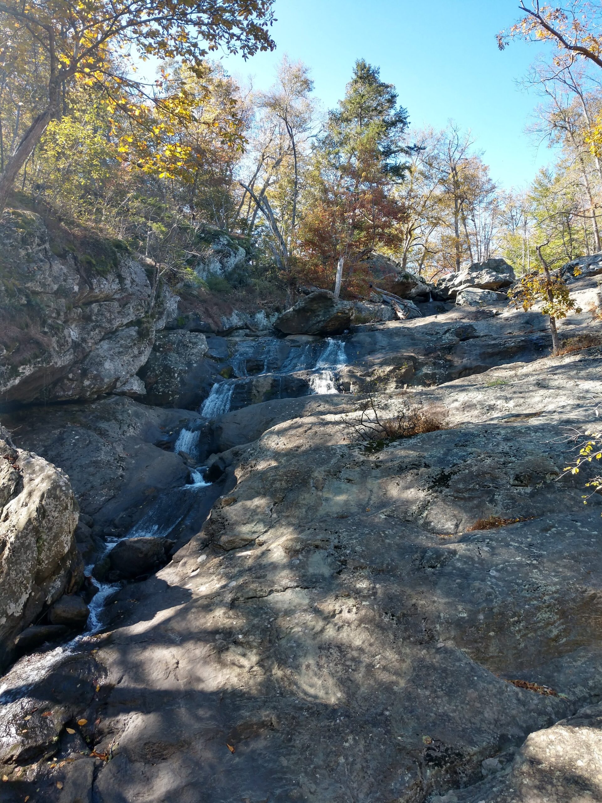
Cunningham Falls represents a tiny portion of the 100,000 miles of streams in the Chesapeake Bay watershed. This water will eventually drain into the Monocacy River, and the Potomac River before reaching the Chesapeake Bay.
Photo courtesy of Chris Pupke.
Wastewater
To remove the Chesapeake from the EPA’s 303d list, the various states have worked together to reduce pollution entering the Bay from its various sources with varying levels of success and failure. They have met with reasonable success in addressing wastewater pollution entering the Chesapeake.
The most notable example of this success is the Blue Plains Wastewater Treatment Facility on the Potomac River. Blue Plains treats the water for the city of Washington, D.C. and parts of surrounding Maryland and Virginia. By the late 1960’s, fecal coliform counts near the plant tested at 4,000 times the safe level. In 1970, the New York Times wrote:
“Under the bridges that link the capital with Virginia, the 1,500-foot-wide ribbon of water is a repellent, opaque gray-brown, so laden with silt, intestinal bacteria and other pollutants that an official of the water quality agency called it ‘a severe threat to the health of anyone coming in contact with it.’”
-“The Polluted Potomac: Sewage and Politics Create Acute Capital Problem” by Gladwin Hill. New York Times. July 12, 1970, page 46.
Thirty years of improvements at Blue Plains allowed the plant to meet its nitrogen reductions under the Chesapeake 2000 Agreement. Although Blue Plains remains the largest point source polluter in the Bay, it has demonstrated that improvements can be made and indeed the vast majority of reductions of nutrient pollution have come from improvements at wastewater treatment plants.
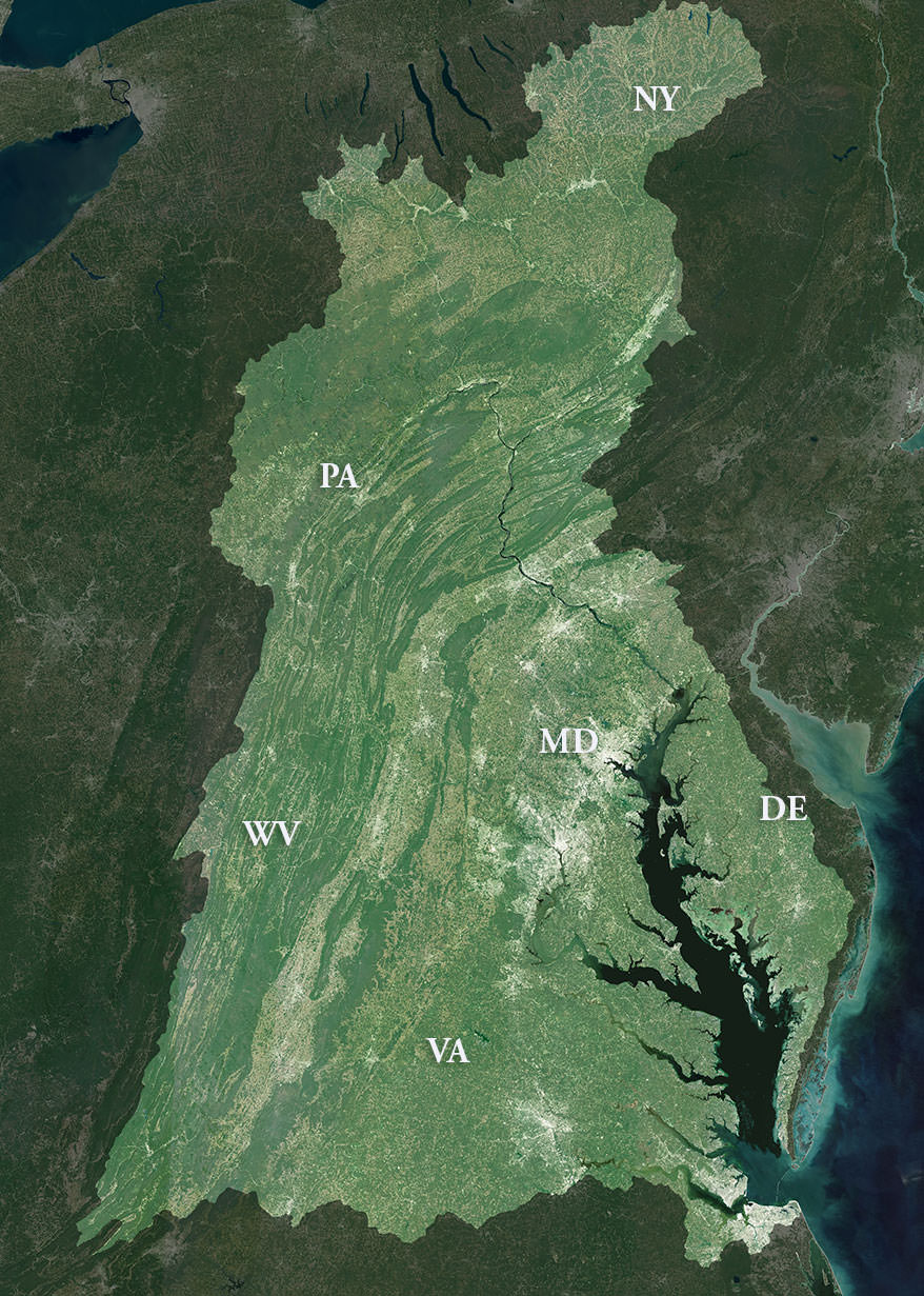
The Chesapeake Bay watershed spreads over 64,000 square miles in six states. The land use decisions by landowners in the watershed collectively have a huge impact on the health of the Bay.
Image from NOAA.
Agriculture
Agriculture, on the other hand, remains a significant issue.
Agriculture continues to be the largest source of nutrient pollution in the Chesapeake Bay. The EPA’s Chesapeake Bay Program notes that 45% of nitrogen pollution and 50% of the phosphorus in the Bay is generated by agriculture.
Unfortunately, efforts to reduce ag pollution have lagged. It’s not that we don’t know how to reduce this pollution. Science shows that restored wetlands can reduce nutrient pollution by as much as 70%. Buffers along streams, creeks and rivers can filter up to 50% of nutrient pollution. Simply said, we need more – more restored wetlands, more buffers planted, and most of all, more political will to address the problem of agricultural pollution.
Ag is a leaky system. By design, excess water is diverted off farm fields as quickly as possible, taking with it nutrient pollution. Given the geography of the Chesapeake, this is bad for water quality. Ag pollution is preventing the Chesapeake Bay from recovering and being removed from the EPA’s bodies of impaired waters list.
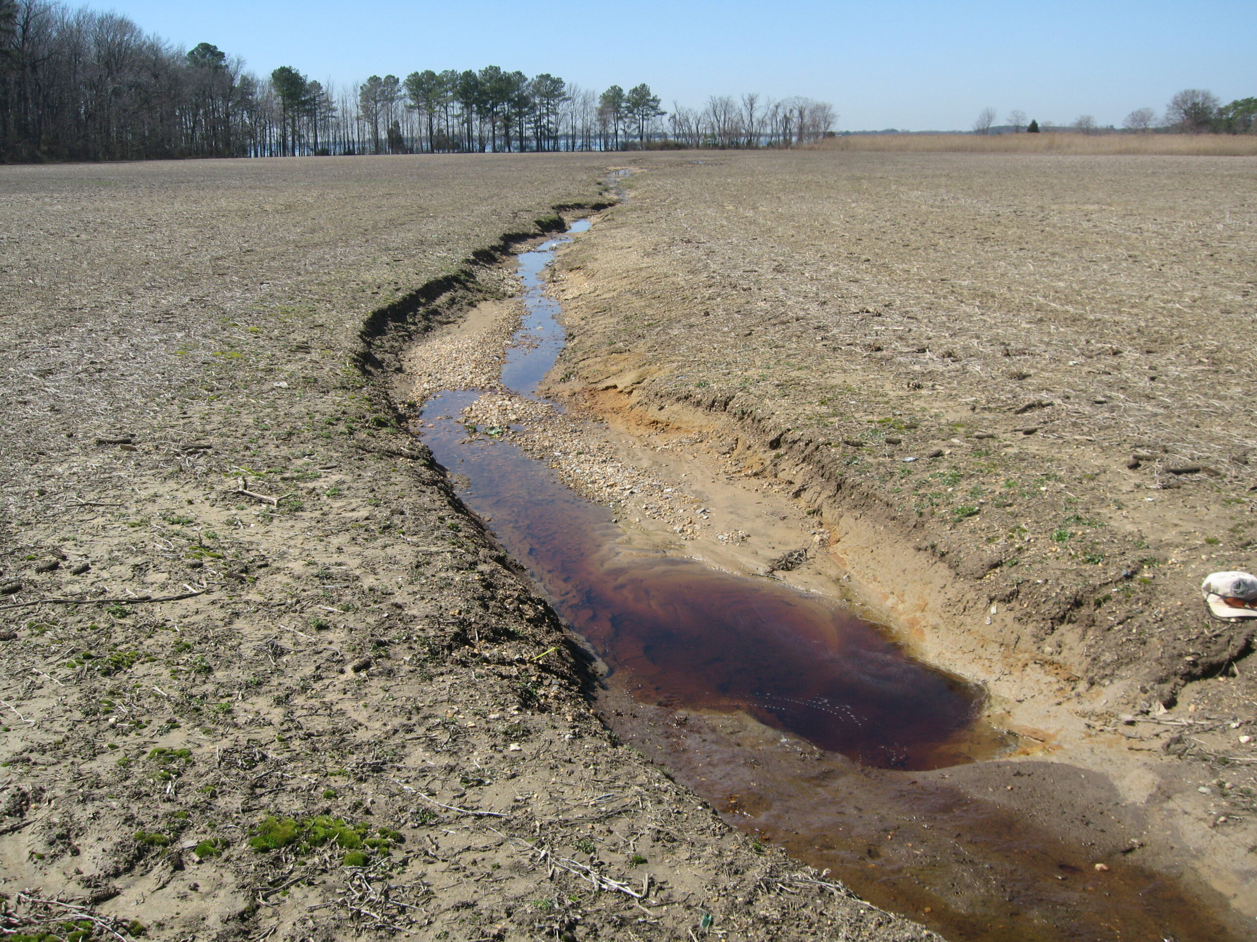
The loss of habitat in the Chesapeake Bay watershed has undermined water quality in the Bay itself. Here, a non-tidal wetland was drained and converted to an ag field. The sediment pollution is evident, but the invisible nutrient pollution (nitrogen and phosphorus) is just as problematic. Prospect Bay, a tidal portion of the Chesapeake, can be seen in the distance.
Photo courtesy of Chris Pupke.
What Biophilia Has Done
In the two decades since Biophilia Foundation was founded, the Chesapeake Bay has been an important focus of our work –most particularly our work to buy, restore and resell farms on the Eastern Shore of Maryland. This work, done in partnership with Chesapeake Wildlife Heritage, resulted in the restoration of 257 acres of wetlands, the reforestation of 77 acres, the planting of 90 acres of buffers and the protection of 1,102 acres of habitat.
Biophilia Foundation is proud of this legacy. It has provided critical habitat for endangered wildlife on the land and improved water quality in the Chesapeake Bay. It provides a clear example of how we can successfully address the problem of agriculture pollution.
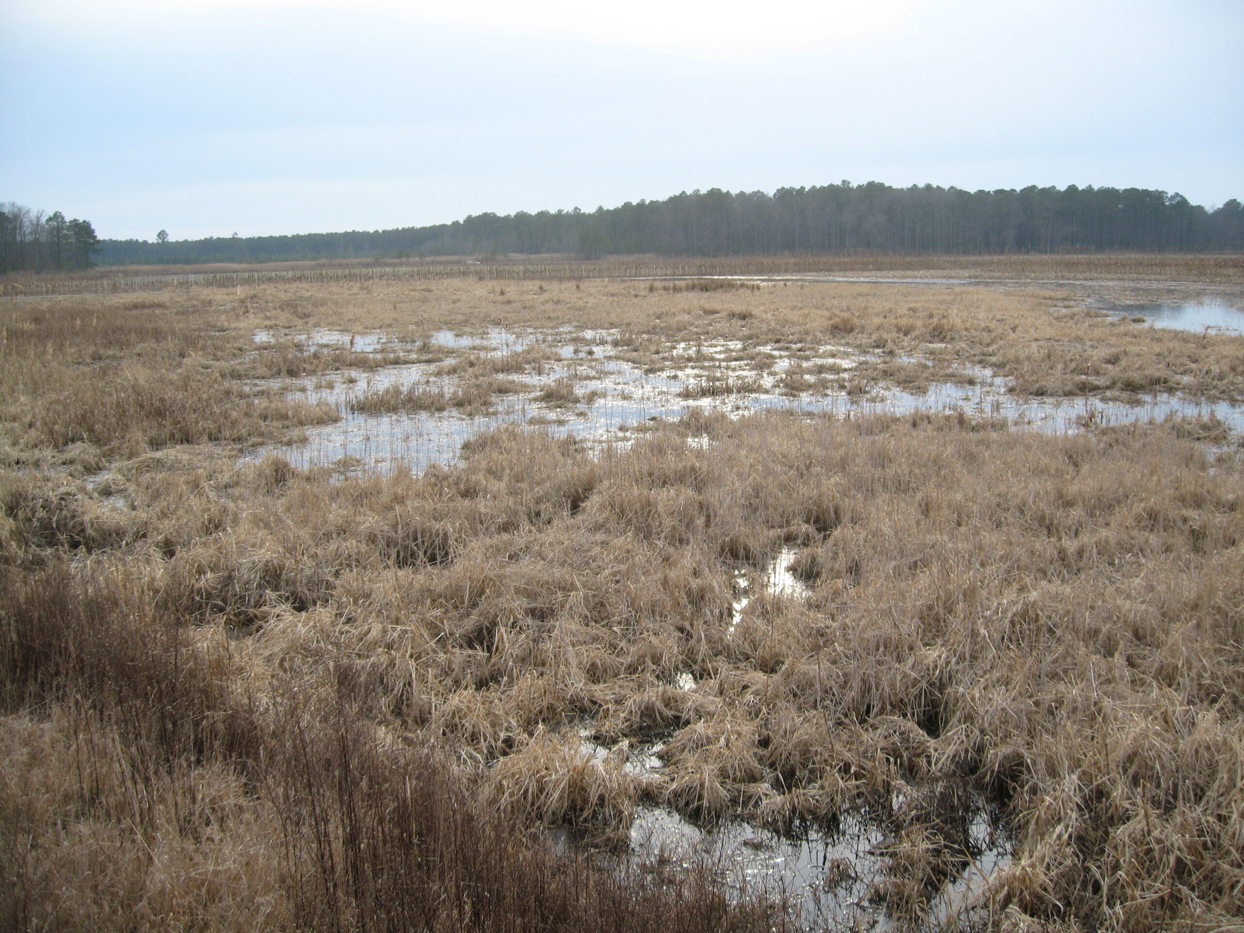
This non-tidal wetland was restored adjacent to the Chicamacomico River through a partnership between Biophilia Foundation and Chesapeake Wildlife Heritage. Previously a cornfield, the restored wetland improves water quality and increases wildlife habitat.
Photo courtesy of Chris Pupke.
Sources
https://www.chesapeakebay.net/discover/facts
https://www.chesapeakebay.net/issues/agriculture
Davison, Steven G. et al. Chesapeake Waters: Four Centuries of Controversy, Concern, and Legislation Second Edition. Tidewater Publishers, Centreville, MD. 1997.
https://www.govinfo.gov/content/pkg/FR-1998-12-30/pdf/98-34548.pdf
https://project.geo.msu.edu/geogmich/lakeontario.html
https://www.vims.edu/research/topics/dead_zones/_docs/2021_cb_hypoxia_report.pdf
Whigham, D.F., T.E. Jordan, A.L. Pepin, M.A. Pittek, K.H. Hofmockel, and N. Gerber. 1999. “Nutrient Retention and Vegetation Dynamics in Restored Freshwater Wetlands on the Maryland Coastal Plain: Final Report.” Smithsonian Environmental Research Center, Edgewater, MD.

